Dolly Sods Wilderness: A Touch of Canada in West Virginia |
Nestled in the Monongahela National Forest in northeastern West Virginia, sits a unique wilderness area of amazing diversity and beauty. The wind swept plains and upland bogs of Dolly Sods are more characteristic of northern Canadian tundra than the surrounding eastern hardwood forests. The spectacular scenery transforms from an open rolling plateau in the north, punctuated by flagged spruce trees and rocky boulder fields, into the steep, forested Red Creek canyon to the south. Along the western edge of the plateau views span across broad Canaan Valley, and from the eastern overlooks vistas reach into Virginia across successive mountain ridges. Though the Dolly Sods area as it exists now is a direct result of destructive foresting long before becoming a wilderness, the region still retains a wildness that refuses to be tamed by man.
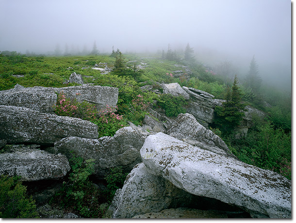
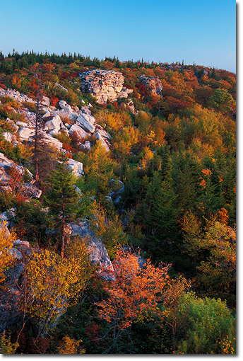
At an elevation of nearly 4000 feet, the Allegheny Plateau forms the northern edge of Dolly Sods and serves as the headwaters of the Left and Right Forks of Red Creek which join to cut through the center of the wilderness to the south. Named after an early pioneer family, the region was logged through the early 1900's and subsequent fires burned through the topsoil and thick humus layers to expose the rocky terrain below. While the steep hillsides of the Red Creek canyon have recovered with a mature hardwood and hemlock second growth forest, strong and persistent winds across the plateau have slowed the redevelopment of the red spruce and alder forest . In the open areas, even older spruce trees struggle to grow above head height with their only branches spreading to the lee of the western winds. Across the miles wide rolling plains, large, barren boulder fields can still be found in addition to rocky outcrops along the edges of the plateau.
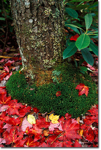
The variety of unique features found in a compact region make Dolly Sods a paradise for hikers, nature lovers, and photographers alike. All around the upper rim of the canyon, small streams cascade over waterfalls as they tumble to meet Red Creek below. Following the blossoming of spring wildflowers in May, rhododendron, azalea, and mountain laurel thickets bloom along the edges of the plateau throughout June. As the end of summer approaches, the open fields to the north are filled with ripening blueberry bushes whose leaves will turn fiery red in autumn. Upland bogs in the low lying areas support sphagnum moss, wild cranberries, and cotton grass which all contribute to a rich, earthy scent that characterizes the area. Between open stretches of the plains and tucked within the rolling terrain, fern filled stands of stunted maple trees are permeated with a sweet hay scented aroma in the fall. Peak autumn color begins the first week of October in the higher elevations and stretches into the middle of October for the Red Creek valley. Throughout winter, the sporadic heavy summer rains are replaced with equally intense snowfall that transform the area into a white, sculpted wonderland perfect for skiing or snowshoeing.
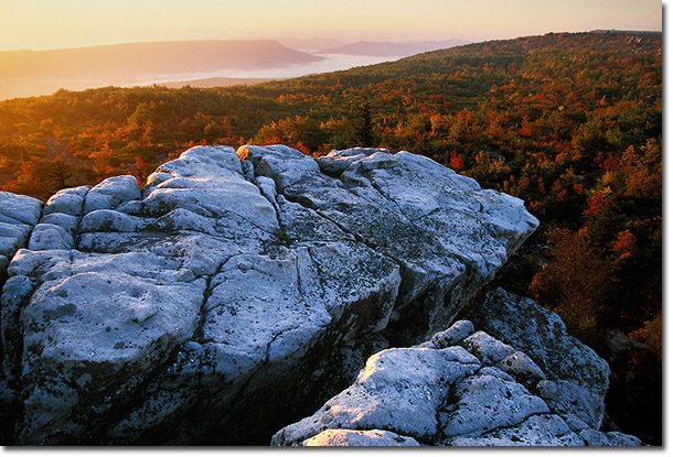
If you visit, don't miss the sculpted rocks, blueberry fields, and broad vistas at Bear Rocks just beyond the large parking area at the northern end of FR75. Halfway between FR19 and Bear Rocks is the Red Creek campground with 12 primitive campsites, and just north of the campground the popular Blackbird Knob trail crosses to the western side of the plateau and provides access both north to the boggy plains and south to the forks of the Red Creek. Another recommended trail is Rohrbaugh Plains which begins in the south and leads north to rocky outcrops with vistas of the lower Red Creek valley. Regardless of the time of year, always plan for extreme weather variations in Dolly Sods including cooler temperatures and rain triggered by the sharply rising terrain. While the trails are well tread, there are no blazes within the wilderness and signs only mark the major trail intersections. GPS generated maps (available here) combined with USGS topo maps provide the most accurate means of navigating the unmarked northern trails. If visiting in the winter, be mindful of potential road closures on FR75 due to deep and drifting snow. Additional information on Dolly Sods can also be found on the Forest Service website.
Comments on NPN nature photography articles? Send them to the editor. NPN members may also log in and leave their comments below.
John Zinn is a fine art landscape photographer based out of Pittsburgh, Pennsylvania. His passion for photography has grown from a love for adventure and a desire to capture the beauty of our natural world. With over thirteen years of experience, John transitioned to large format photography ten years ago and it remains his preferred medium. Visit John's website to see more of his photography at www.EnduringLightPhotography.com.